Wednesday, March 2, 2011

Aerial Map - History as Dimension

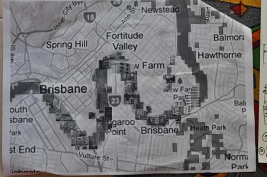
I wanted to represent history around 1860 in an aerial view, when Brisbane River had been recently 'settled'. I have gathered etched/photo reference on the area from 1829 – 1900. It's incredible how, by 1860 – from arriving in Brisbane port (in 1829) - the landscape had changed dramatically ... housing, city, removal of mangroves, river dredging for port and shipping activity: it was all well underway.

I am always interested in that idea of history and the point when everything 'became something else' – the point of no return I guess. I believe 1860 was the year, the river became something 'else'.

Because of the time in history, I wanted to return to a more traditional method of 'stitching' the landscape as an aerial view.

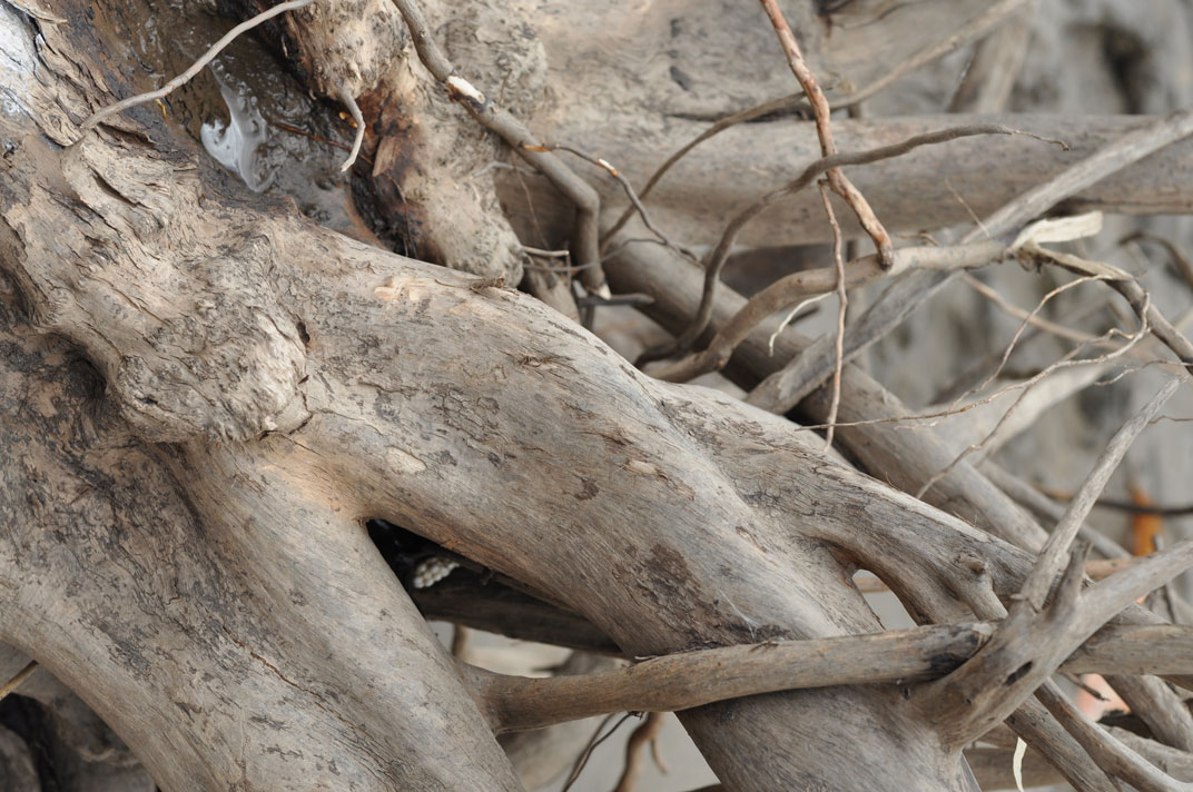
I wanted to try as many methods as possible for the final submission and hoped to capture 'pasts and present' of the river- especially as I've found the memories/experiences and perspectives change each time I visit, or plan the next exercise. Also, every time I read more about the site, my understanding changes. This exercise was a good opportunity to work with stitching. An initial 'stitched canvas' was made at the River, specifically at the Kangaroo Point mangroves, where I recorded textures and colours.

Brisbane River recorded between 1865 – 1875


Later, materials taken from the site (such as wood, line work, painted canvas and stitch work) was used to create the final piece. Nothing was wasted.
There is a mix of linear drawing, stitching, photographs, painted canvas, felt and cotton fabrics, chicken wire, copper wire and materials taken from the site to reference certain parts of the river.


Site2_Dimensional Maps_contd.

Experiences as Projections

Projected photographs over original Brisbane River Map @4.25 m. Photgraphs taken the weekend after the Brisbane River flooded in January 2011.

Influences - Mark Datodi and Diana Thater

Experiences as Images:
From Vulture Street to Shaftston Avenue
From Vulture Street to Shaftston Avenue II
Brisbane Metro Map Projection
Brisbane Floods – Experiences
Rescue
Brisbane Floods – Unity
Media


>

Site 2_Dimensional Maps_contd.

The objective here was to present an experience of the river as it is today - whether it's my experience or the river's experience. The mangroves at Kangaroo Point is roughly a 200m stretch and is fairly accessible, so this is where I my initial recordings. Again, the elements suggest a 'push/pull' relationship between man and nature... one that ultimately nature has to win in order to keep the balance. There is an unrelenting force between tide and the growth of of the mangroves - no matter how much development goes on around them, they keep constant and replenishing.


Interesting to note here, that the mangroves along the Brisbane River were stripped almost entirely, except for selected areas along West End to South Bank, QUT gardens and the Kangaroo Point by 1997. Subsequently, a regulation was passed stopping the removal of mangroves along this stretch. Not surprisingly, between 2007 and 2010 the whole of the South Bank mangrove area was stripped, to "ensure visitors "can enjoy new quality green space". (http://www.couriermail.com.au/news/queensland/south-bank-corporation-removing-brisbane-river-mangroves-so-visitors-can-enjoy-green-space/story-e6freoof-1225893651709)


Click on link to view moving image
http://vimeo.com/20161501

Wednesday, February 23, 2011

Site_2_Dimensional Map_Initial Investigations

Initial Investigations - Dimensional Map

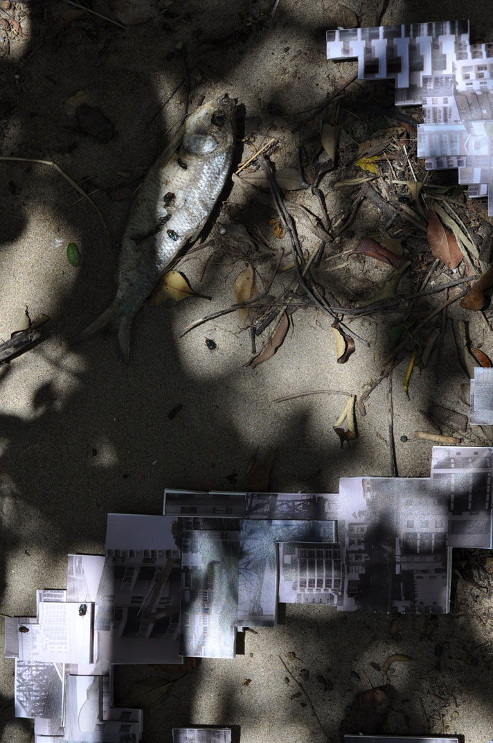
Again, the idea of reflection and shadow came up as something I wanted to experiment with, but this time in a sort of 'removed' fashion.... I wanted to start with a 3dimensional 'architectural rendering' of the Brisbane River... the materials were initially architects board/foam board, pins, thread, wire and electrical tape.

My influences are James Coburn, Louise Forthun, Mark Datodi and Diana Thater for this exercise.

Data
I visited the NASA website and found mapped data for the 2011 floods @ 4.25m (roughly what it reached) and used my photographs of blocks of apartments - mostly the apartments that were affected - and created the 'data' I found of the flood and information found in a white paper of 'The Aesthetics of living on the Brisbane River'...

I intend to experiment with projection to map the nature, interventions, contradictions etc., keeping with the theme of exercise 1.


Site_2_Linear Map

There will always be the 'conflict' between the human vs. nature element of our modern environments.

SITE - Create a Linear Map
Explore the River's history as a linear map: I worked with glass, biodegradable paints, liquid chalk, transfer stencils, permanent markers, and twine.... and where possible light, reflection and shadows.

Intention – to represent the river not as a singularly dimensional site , but as an ever changing environment with line and form. I didn't want to focus purely on the geographical aspects of the river as much as the experiences of the river, where each moment suggests a new or changed part of the river's existence. For this reason, I did each piece as an installation.


Again, the transformation (change over time) was digitally recorded.


Material and Conceptual Investigations_9

SUBJECT - SITE
My intention was to explore materiality and how my experiences of the Brisbane River changed over time.

I visited my site each weekend over a five week period, from the week of the 2011 January floods until now. Each visit resulted in different outcomes, depending on what information I had involved myself in that week, or issues I'd encountered at or around the site over the five week period.


SITE - DIARISING THE SITE
My intention with these photographs was to plot a site - the Brisbane River - and to photograph changes in the river's edges, textures, shadows and tides over time.


DIGITAL/PROJECTION and TEXTILES
I also took this opportunity to explore concepts of 'materiality/non-physical' materiality, experimenting with techniques and methods of getting across the concept of man vs. nature... mostly the nature of nature. Nature is continuous, no matter what man made 'intervention' is constructed in its path.

Over the five weeks, I experimented with projections, digital capturing of experiences and natural change, as well as sewing, gathering/assemblage, installations and poetry.


http://espace.uq.edu.au/eserv/UQ:163451/Skinner_NorthBank_Espace.pdf
http://espace.uq.edu.au/eserv/UQ:210143/p9780646519197_2_119.pdf - Mary Burns Bnsbane: whither art thou?
http://espace.uq.edu.au/eserv/UQ:210083/s00855804_1972_1973_9_4_9.pdf - http://espace.uq.edu.au/eserv/UQ:207504/s18378366_1920_2_1_46.pdf - The Discovery of the Brisbane River.
John Oxley's Missing Journal of 1823.
http://espace.uq.edu.au/eserv/UQ:207326/s18378366_1919_1_6_341.pdf - When WooUoongabba was Wattle- Scented. BY CHAS. MELTON. 1918
Linking Heritage – Up, Down and Around the Brisbane River (A Contextual History) by Dr Rod Fisher (Consultant Historial) June 2007
http://www.ourindooroopilly.com/brisbane-history.html
http://www.ourindooroopilly.com/brisbane-river-map.html
http://en.wikipedia.org/wiki/Brisbane_River

Wednesday, February 9, 2011

Material and Conceptual Investigations_8

Traditional works - I've started with the final pieces first... the craft of applique and reverse applique was used on these objects... I have great respect for these crafts and felt that the investigations into the molas of the Kuna peoples was a great place to start in terms of the choice of colour, culture, subject matter of each beautiful piece...

A few reference sites:
http://anthromuseum.missouri.edu/minigalleries/panamamolas/intro.shtml
http://www.molagirl.com/j/content/view/25/29/

Anyway, to my examples. My objective was to create three dimensional 'reverse/appliqued' objects with a focus on the textures of each chosen 'fibre' - from tulle to chicken wire and paper...


1. Materials: rope, tulle, cotton and embroidery threads, woven mat, chicken wire
Observations: sewing tulle to rope is difficult using embroidery thread, so I sewed one stitch, then cut and tied the thread (black) - this created an interesting visual to the rope 'cone'. The rope was easier to sew into when wet. Tulle pulls into shape quite easily.


2. Materials: hat mesh, tulle, copper wiring, embroidery and cotton thread, and cut out papers (used in project 2, ex 2)
Observations: the hat mesh was brilliant, you can pull and fray it. the fragility of both the tulle and this mesh however caused it unravel itself, so I sewed in the red embroidery thread and copper wiring as a sort of reinforcement... great thing there is you can manipulate the shape of the tube, so I experimented with round, U shapes and others


3. Method: Moist wood bark, apholstery pieces, kebab sticks, chicken wire pieces, satin, leather, embroidery, cotton and copper thread.
Observations: Making the bark damp keeps it softer and easier to work with, bark and leather are very tough to sew through together, copper thread tends to 'twine' up. Chicken wire and kebab skewers good for keeping the overall shape.